Pokuttіa
Покуття
Pokuttіa
Покуття

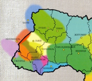
Pokuttia is shown in pink on the ethnographic map of Ukraine (right). It is surrounded by Bukovyna (SE, blue), Hutsulshchyna (SW, purple), and Podillia (NE across the Dnister river, green).
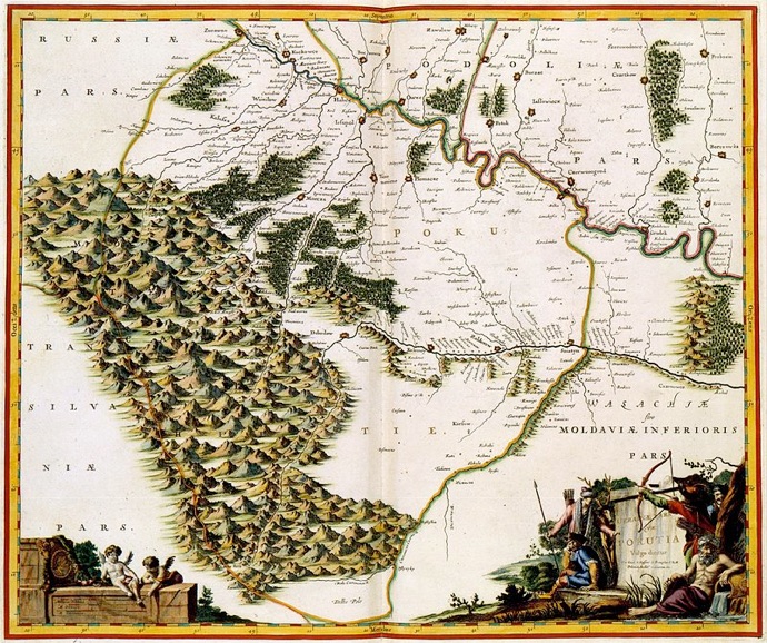
In the map at the top of this page, it is the area labelled “POKU”; there are the Carpathian mountains to the west, while Pokuttia has foothills, forests and mostly plains. The Prut river in the southern part of Pokuttia can be seen to have hills along its southern aspect.
Pokuttia was a part of Kyivan Rus and its successor state, the kingdom of Halych-Volyhnia. It was later under the rule of Poland, Moldavia, Austria-Hungary and (in part) Romania. After WWII it became part of the USSR and, in 1991, of an independent Ukraine.
Although the historical centre of the area was Kolomyia, the name itself is derived from the name of the town of Kuty and literally means by Kuty ("Kut" by itself means "corner").
The Carpathian foothills
Back to Carpathian Pysanky Home
Back to Regional Pysanky Home
Back to Traditional Pysanky HOME
Search my site with Google